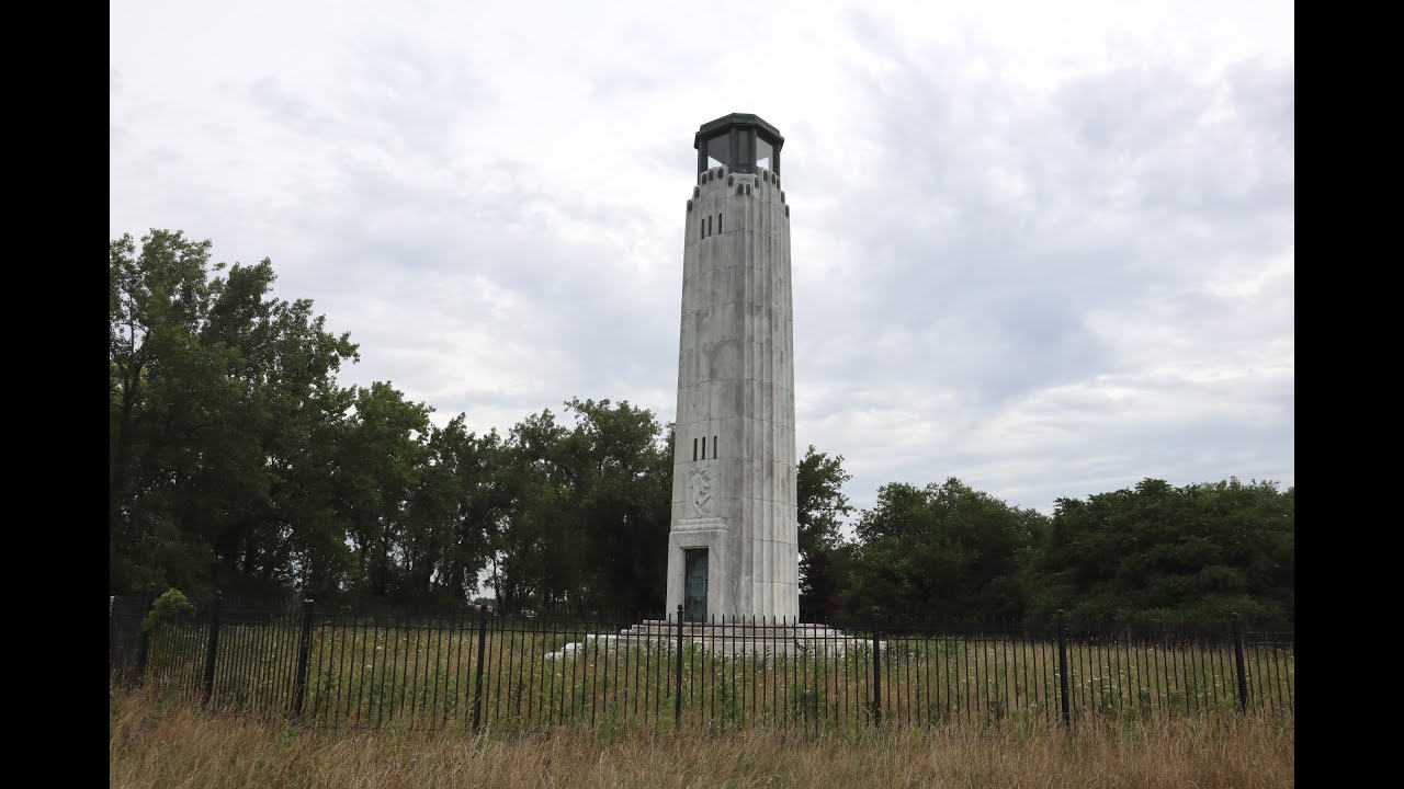
The William Livingstone Memorial Lighthouse (#5 of 129) is located on Belle Isle on the Detroit River
Location: Detroit River
Coordinates: 42°20'49.4"N 82°57'15.5"W
Structure: White Marble
Year First Lit: 1930
Height: 58 feet (18 m)
Lens: 4th Order Fresnel
Fun Fact: This is the only lighthouse in the United States constructed of marble
Maintained by the Detroit Historical Society
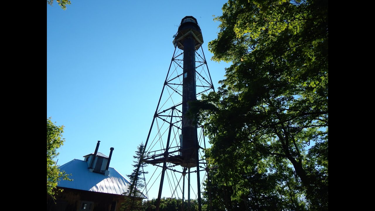
The South Fox Island New Lighthouse (#48 of 129) is a Sanibel Class skeletal tower located on South Fox Island in Lake Michigan and is one of two lighthouses on the island.
Location: Lake Michigan
Coordinates: 45°26′32″N 85°48′36″W
Structure: Sanibel Class Skeletal Tower
Year First Lit: 1934
Focal Height: 89 feet (27 m)
Lens: 4th Order Fresnel
Fun Fact: This tower was disassembled and moved to South Fox Island from another Light Station located on the Sapelo Island in Georgia
Preservation Group: Fox Island Lighthouse Association
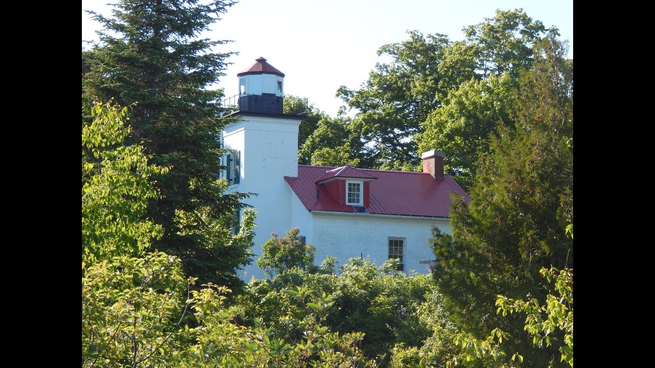
The South Fox Island Old Lighthouse (#47 of 129) is one of two lighthouses located on South Fox Island in Lake Michigan.
Location: Lake Michigan
Coordinates: 45.3785°N 85.8371°W
Structure: Brick
Year First Lit: 1867
Focal Height: 68 feet (21 m)
Lens: 4th Order Fresnel
Fun Fact: In 1880 Keeper Willis Warner had to build a five foot tall fence around the lighthouse to keep back the drifting sand and snow.
Preservation Society: Fox Island Lighthouse Society (FILA)
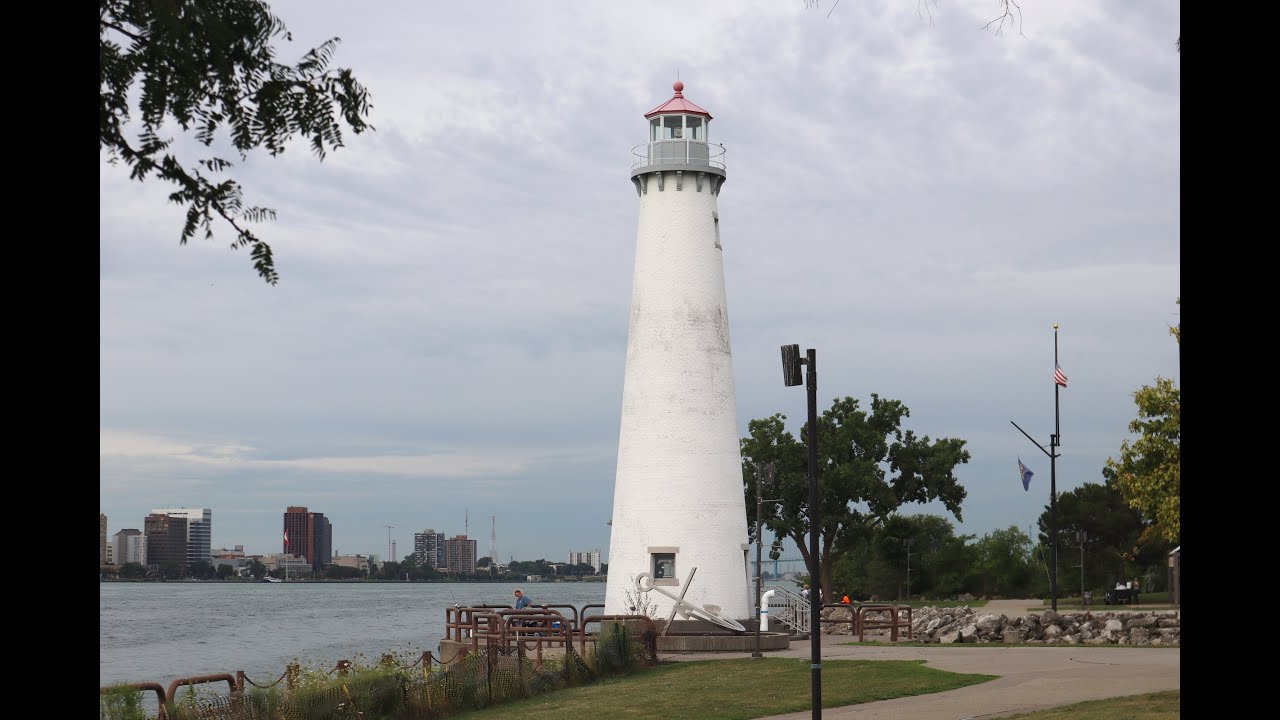
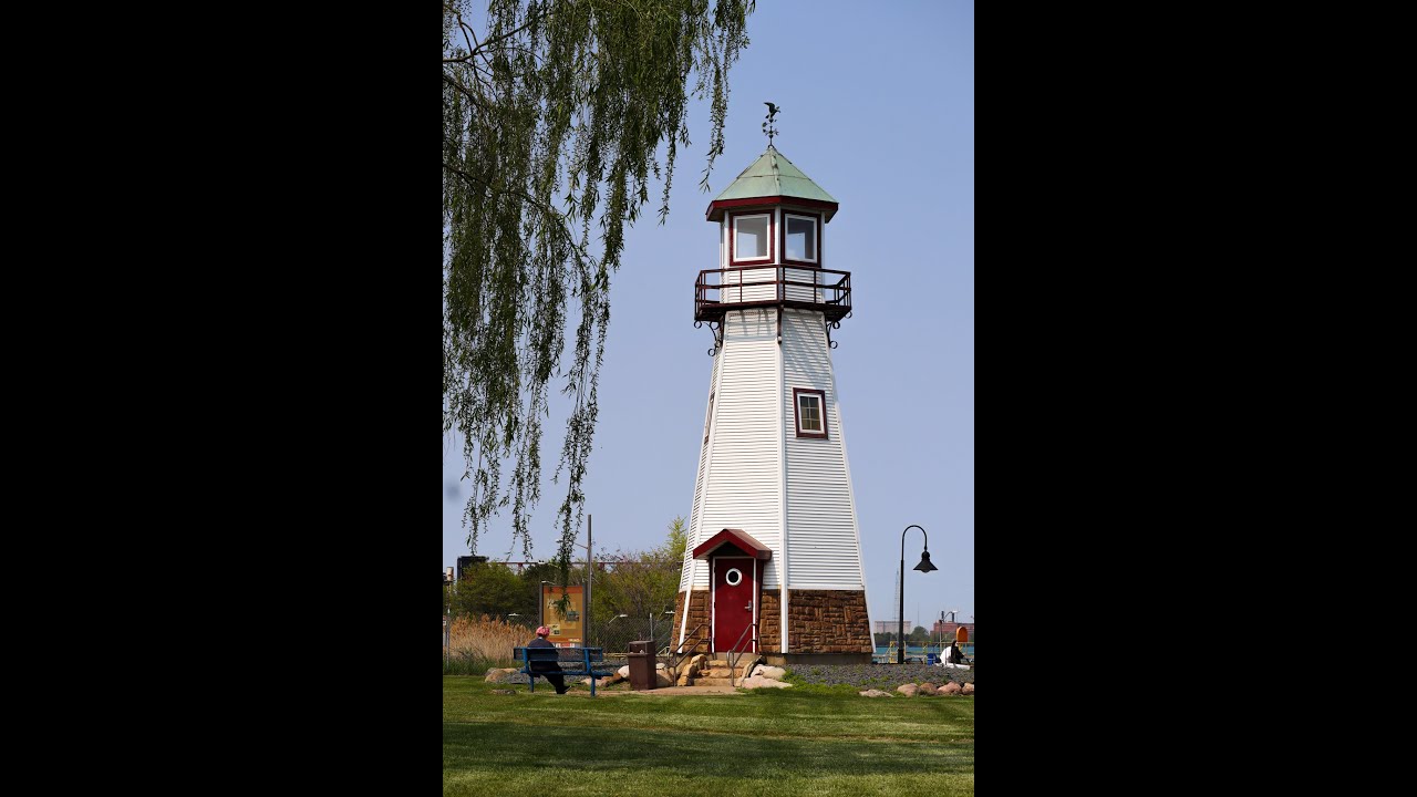
The Milliken State Park Lighthouse (#4 of 129) is located on the Detroit River just east of Detroit, Michigan.
Location: Detroit River
Coordinates: 42°19'57.0"N 83°01'28.8"W
Structure: Brick
Year First Lit: 2004
Height: 63 feet (19 m)
Lens: LED
Fun Fact: This lighthouse is a scaled down replica of Tawas Point and is the newest in Michigan.
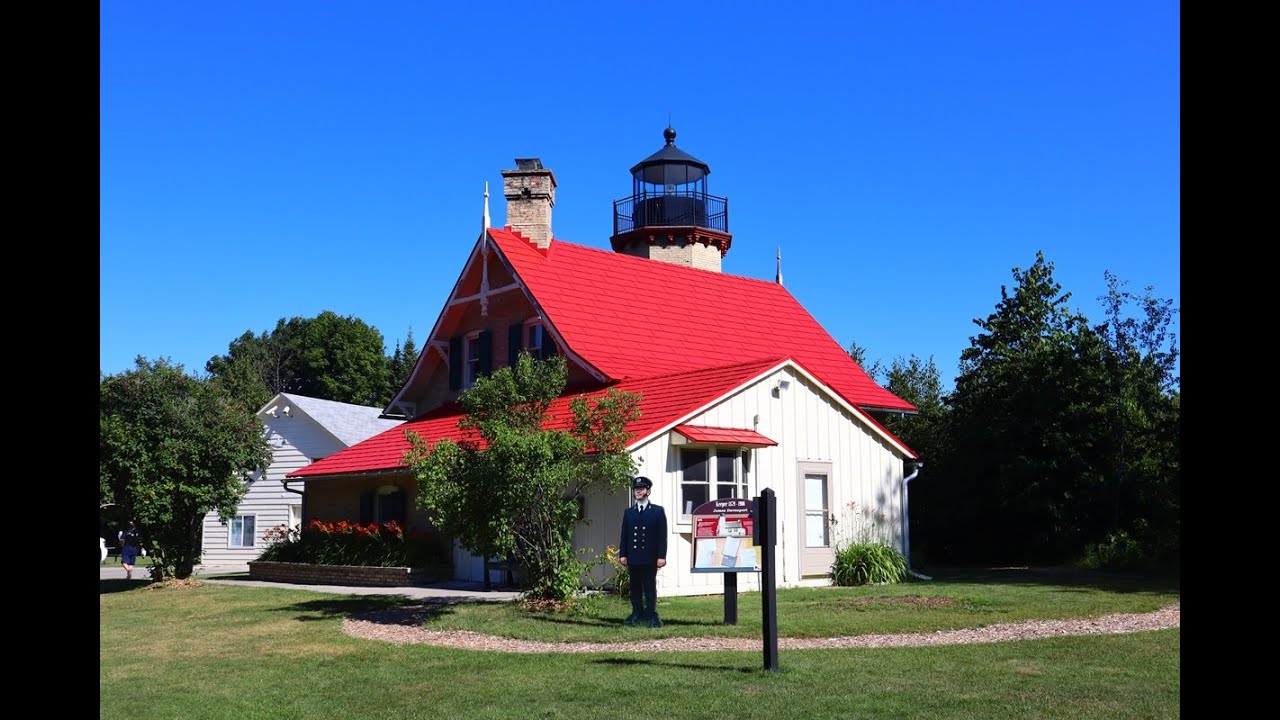
McGulpin Point Lighthouse (#37 of 129) is located west of Mackinaw City, Michigan on the shores of Lake Michigan.
Location: Lake Michigan
Coordinates: 45.78690°N 84.7722°W
Structure: Brick
Year First Lit: 1869
Focal Height: 102 feet (31 m)
Lens: 3.5 Order Fresnel
Fun Fact: James Davenport was the one and only lighthouse keeper for this light, serving for 27 years. During the navigational season he and his wife raised nine children in the small story and a half structure.
Currently being preserved and restored by Emmet County
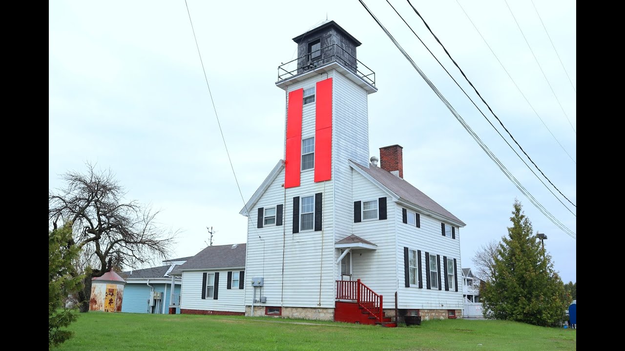
The Cheboygan Front Range Lighthouse (#35 of 129) is located in the northeastern corner of Cheboygan, Michigan alongside the river.
Location: Cheboygan River
Coordinates: 45° 38' 51" N, -84° 28' 22" W
Structure: Wood
Year First Lit: 1880
Focal Height: 42 feet (13m)
Lens: A 6th Order Fresnel that was later replaced with a locomotive style lantern with a 10,000 candlepower electric lamp
Fun Fact: While in operation this light station was responsible for the 41 aids to navigation (AtoN) from Alanson to Cheboygan and was the primary support for three offshore lighthouses along with the Coast Guard icebreaker USCGC Mackinaw (WAGB-83).
Owned and maintained by the Great Lakes Lighthouse Keepers Association (GLLKA)
The Cheboygan Crib Lighthouse (#34 of 129) is located in the Gordon Turner Park on the west breakwater alongside the Cheboygan River. Originally this Light was about an eighth of a mile off the Cheboygan shoreline in Lake Huron where it marked the outer end of the dredged channel into the river.
Location: Cheboygan River/Lake Huron
Coordinates: 45° 39' 23" N, -84° 27' 55" W
Structure: Wood (1st lighthouse), cast iron and concrete (2nd lighthouse)
Year First Lit: 1884 (1st Lighthouse), 1903 (2nd Lighthouse)
Focal Height: 35 feet (11m) (2nd Lighthouse)
Lens: 4th Order Fresnel
Fun Fact: The Coast Guard had planned to demolish the Light but it was instead donated to the City of Cheboygan and moved inland to its current location where it was restored.
Maintained by the City of Cheboygan and local groups
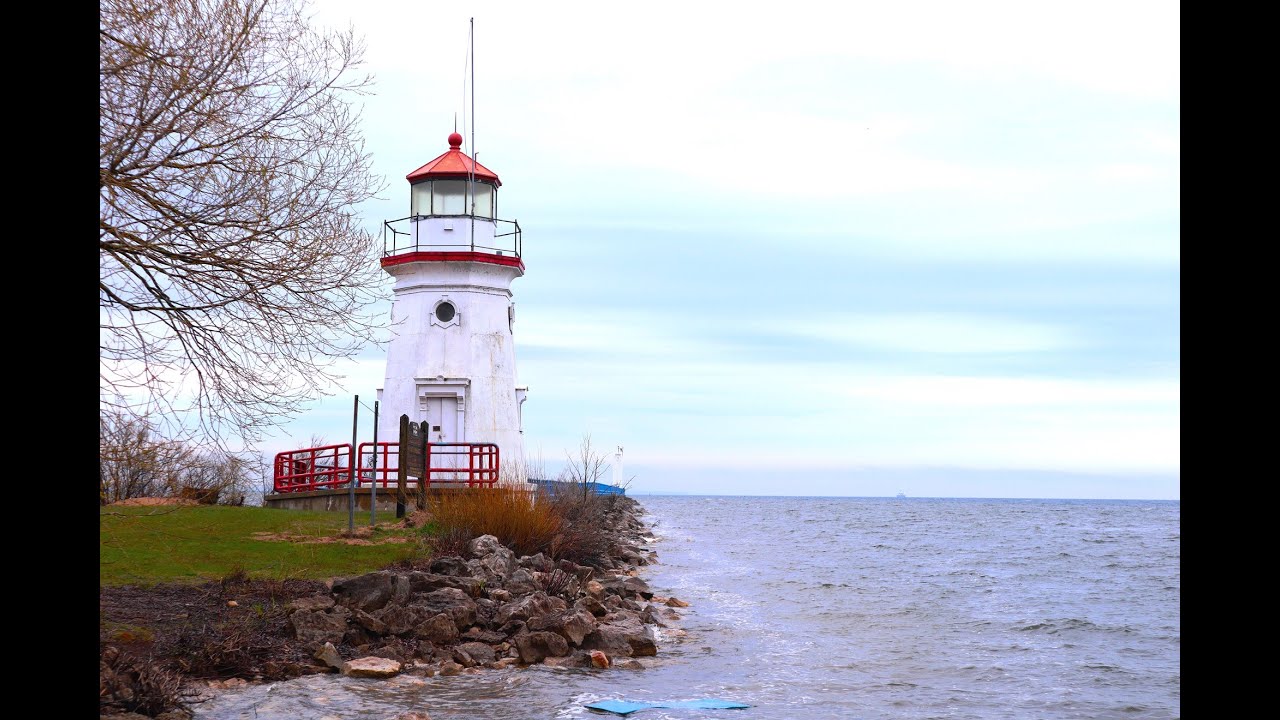
The ruins of the Cheboygan Point Lighthouse (#32 of 129) are located in the Cheboygan State Park just off the shore of Lake Huron in Michigan.
Location: Lake Huron
Coordinates: 45° 40' 8" N, -84° 25' 11" W
Structure: Stone and wood
Year First Lit: 1851 (1st Lighthouse), 1859 (2nd Lighthouse)
Focal Height: 37 feet (11m) (2nd Lighthouse)
Lens: 5th Order Fresnel
Fun Fact: The first tower built in 1851 was poorly placed and its foundations were soon undermined by the lake. It was eventually torn down and replaced in 1859.
The second lighthouse itself was made obsolete by the off shore 14 Foot Shoal (#33 of 129) built in 1930. Cheboygan Point was abandoned and eventually dismantled in the 1940s. All that remains now are the ruins of the foundation.
Owned by the Michigan Department of Natural Resources
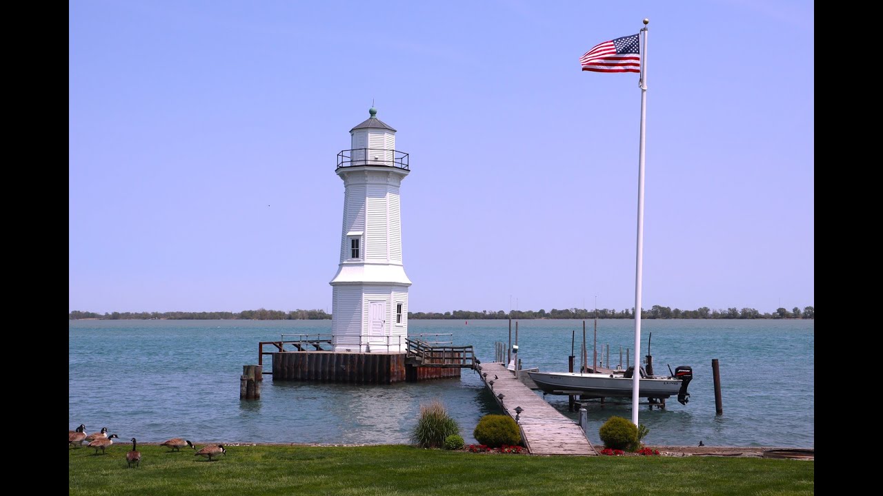
The Mariners Memorial Lighthouse (#3 of 129) resides in the City of River Rouge at the Dr. Henry Belanger Park alongside the Detroit River.
Location: Detroit River
Coordinates: 42° 16' 18" N, 83° 6' 40" W
Structure: Wood
Year First Lit: 2004
Height: 41 feet (12m)
Lens: LED
Fun Fact: This lighthouse was built by 27 volunteers in the summer of 2003 as a tribute to the ship-building heritage of the local community as well as to those that sail the lake and rivers of Michigan. In 2004 it was declared an Aid to Navigation (AtoN) by the US Coast Guard.
Owned by the City of River Rouge
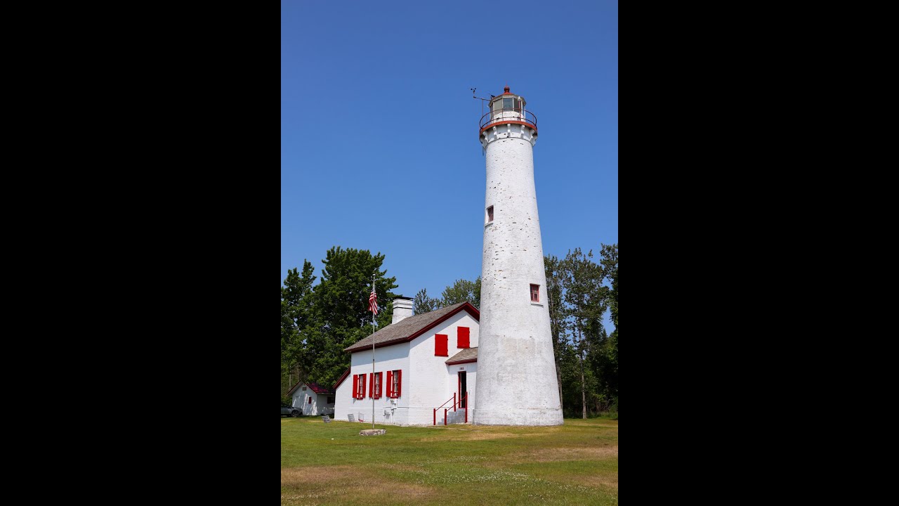
The Sturgeon Point Lighthouse (#22 of 129) is along the shores of Lake Huron in Alcona County and marks a one and a half mile shallow reef that stretches out into the lake.
Location: Lake Huron
Coordinates: 44°42′45.7″N 83°16′21.8″W
Structure: Brick
Year First Lit: 1869
Height: 69 feet (21 m)
Lens: 3-1/2 Order Fresnel Lens
Fun Fact: In 2006 the US Coast Guard attempted to extinguish the light at Sturgeon Point. After public outcry that included a petition with over 5,000 signatures the Coast Guard reversed its decision and the light remains lit to this day as a Private Aid to Navigation.
Owned by the Michigan Department of Natural Resources (DNR) and maintained by Alcona Historical Society
The Grosse Ile North Channel Front Range (#2 of 129) is located on the east side of Grosse Ile along the shore of the Detroit River.
Location: Detroit River
Coordinates: 42° 10' 08" N, -83° 08' 24" W
Structure: Wood
Year First Lit: 1894, rebuilt in 1906
Height: 40 feet (12m)
Lens: 4th Order Fresnel
Fun Fact: The Grosse Ile community came together not once but twice to save the North Channel Front Range from destruction. In 1984 the base of the lighthouse had deteriorated to the point there was fear it would fall over. Luckily a new steel piling and concrete base was poured to keep it standing. Then again in 2019 an ice flow from the Detroit River threatened to push over the structure. However, through jackhammers, pickaxes, and brute strength the crisis was averted.
Owned and maintained by the Grosse Ile Historical Society
Please note that this lighthouse is not accessible to the public, respect people's private property. Visit the Grosse Ile Historical Society website for scheduled tour dates.
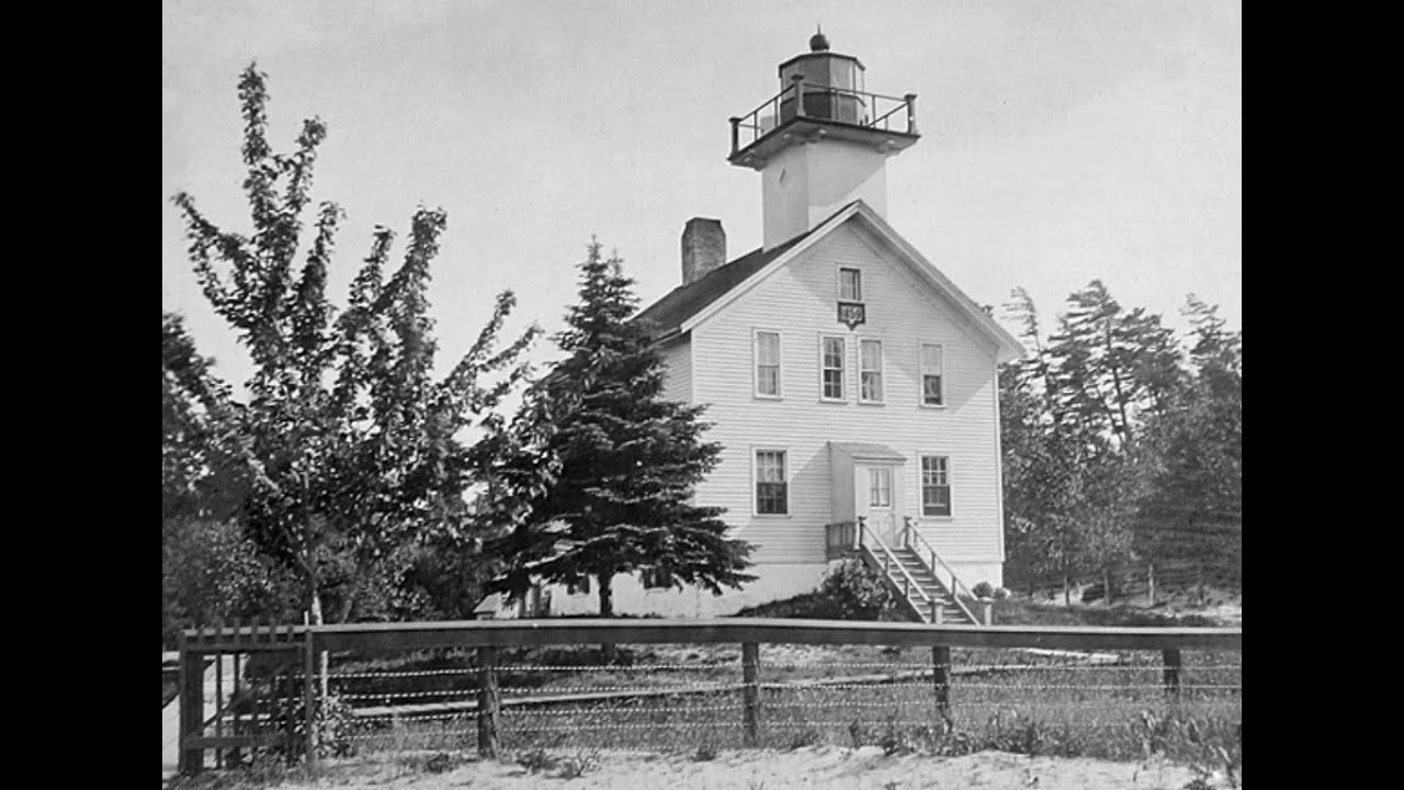
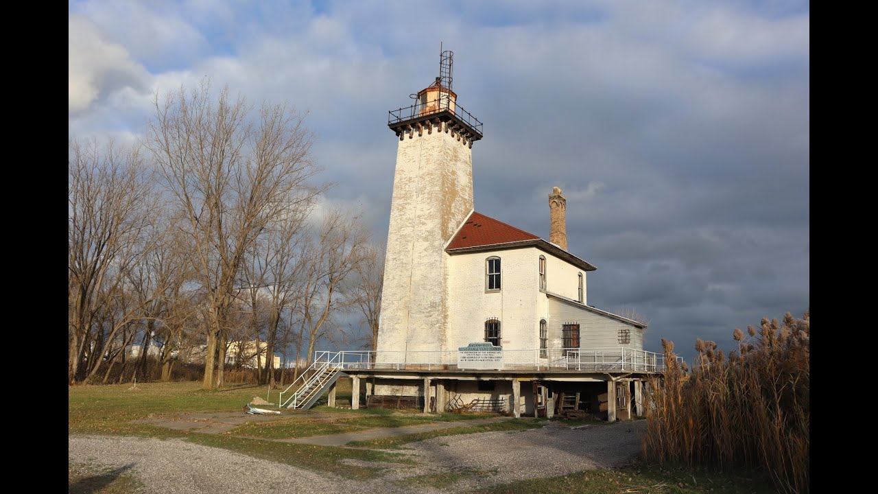
The Saginaw River Rear Range Lighthouse is located on the Saginaw River northeast of Bay City on Dow Chemical Company property.
Location: Saginaw River
Coordinates: 43°38′7.8″N 83°51′2″W
Structure: Brick
Year First Lit: 1876
Focal Height: 61 feet (19 m)
Lens: 4th Order Fresnel
Fun Fact: After being told to paint just the tower the crew, who were upset with their supervisor, decided instead to paint the whole lighthouse white.
Preservation Group: Saginaw River Marine Historical Society
The Shoal Shoppe is home to a wide variety of fantastic lighthouse products, merch, and more! Check out our full collection and see what makes the beacons of Michigan so special.