The Pointe Aux Barques Lighthouse (#16 of 129) is at the tip of Michigan's "thumb" on Lake Huron.
Location: Lake Huron
Coordinates: 44°01′24″N 82°47′36″W
Structure: Brick
Year First Lit: 1848
Focal Height: 93 feet (28 m)
Lens: 3rd Order Fresnel
Fun Fact: After the death of her husband Catherine Shook became the first lighthouse keeper in Michigan, a position she held from 1849 to 1851.
Preservation Group: Pointe aux Barques Lighthouse Society (PaBLS)
The Harbor Beach Lighthouse (#15 of 129) resides to the east of the City of Harbor Beach on Lake Huron and is located at the end of the harbor's north breakwall.
Location: Lake Huron
Coordinates: 43°50′42″N 82°37′54″W
Structure: Cast Iron
Year First Lit: 1876 (1st light), 1885 (current light)
Focal Height: 54 feet (16m) (current light)
Lens: 4th Order Fresnel
Fun Fact: This lighthouse stands guard at the entrance of the largest man-made freshwater harbor in the world. It took 11 years to build all three breakwaters and together the harbor provides over 650 acres of shelter.
Owned by the City of Harbor Beach and maintained by Harbor Beach Lighthouse Preservation Society (HBLPS)
The Port Sanilac Lighthouse (#14 of 129) is located in the Village of Port Sanilac, Michigan on the shores of Lake Huron.
Location: Lake Huron
Coordinates: 43°25′44″N 82°32′24″W
Structure: Brick
Year First Lit: 1886
Focal Height: 69 feet (21 m)
Lens: 4th Order Fresnel
Fun Fact: Jeff Shook who owns the Port Sanilac Lighthouse is descended from Michigan's first woman lighthouse keeper Catherine Shook.
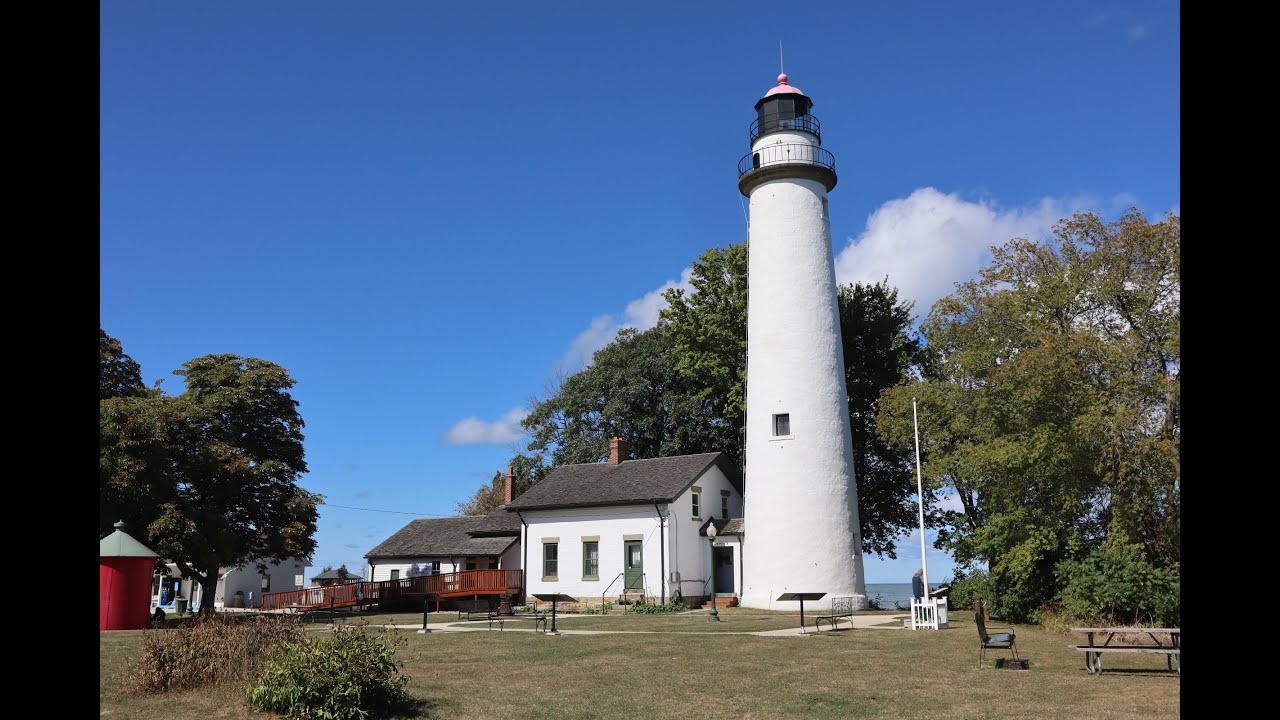
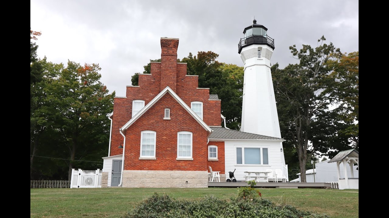
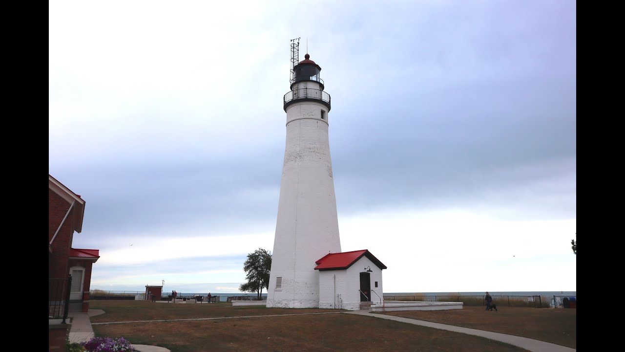
The Fort Gratiot Lighthouse (#13 of 129) is located in Port Huron, Michigan on Lake Huron.
Location: Lake Huron
Coordinates: 43°0′22.7″N 82°25′20.9″W
Structure: Brick
Year First Lit: 1825
Height: 82 feet (25 m)
Lens: 4th Order Fresnel until 1862, then replaced with a 3rd Order
Fun Fact: Fort Gratiot is the oldest surviving Lighthouse in Michigan
Preservation Group: Port Huron Museums
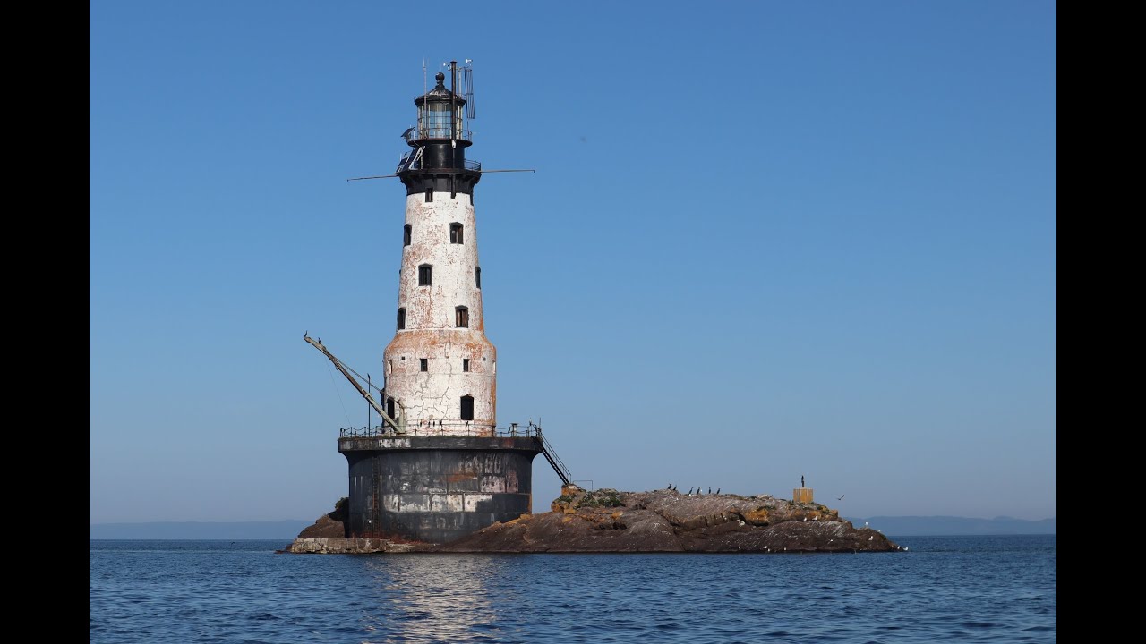
The Rock of Ages Lighthouse (#126 of 129) is located off shore at the south end of Isle Royale in Lake Superior.
Location: Lake Superior
Coordinates: 47°52′00″N 89°18′48″W
Structure: Brick and plate steel
Year First Lit: 1910
Focal Height: 130 feet (40 m)
Lens: 2nd Order Bivalve Fresnel Lens
Fun Fact: It was customary for passengers to sing the "Rock of Ages" hymn as their ship passed by the Lighthouse.
Preservation Group: Rock of Ages Lighthouse Preservation Society
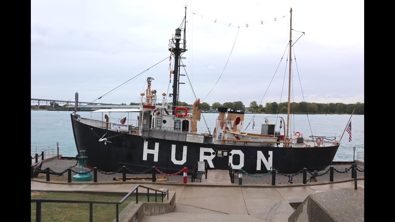
The Huron Lightship LV-103 (#12 of 129) is currently moored on the St Clair River in the City of Port Huron, Michigan.Location: St Clair River Coordinates: 42°59′21″N 82°25′36″W
Structure: Lightvessel
Year First Lit: 1921
Focal Height: 52 feet (16 m)
Lens: 375mmFun Fact: The Huron Lightship LV-103 is the only lightvessel on the Great Lakes retiring from the Coast Guard service in 1970.Preservation Group: Port Huron Museums
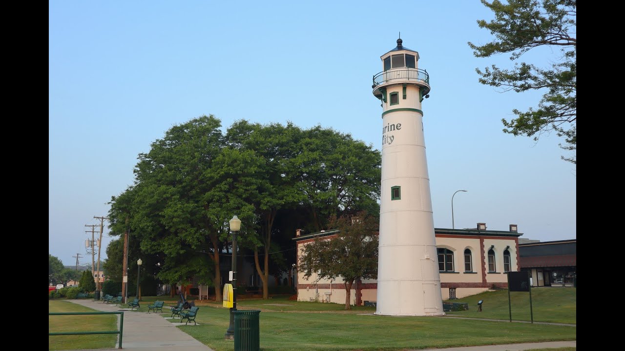
The Peche Island Rear Range Lighthouse (#11 of 129) is located alongside the St Clair River in Marine City.
Location: St Clair River
Coordinates: 42° 43' 35" N, -82° 29' 20" W
Structure: Steel plate
Year First Lit: 1908
Focal Height: 57.5 feet (17.5m)
Lens: Fixed red reflector
Fun Fact: This lighthouse was one of a pair of range lights that guided ships to the mouth of the Detroit River from Lake St Clair northeast of Peche Island. By 1970 it had developed a severe lean to one side and was eventually deactivated in 1983. The light was then moved to shore and now resides at Lighthouse Park in Marine City.
Owned and maintained by City of Marine City
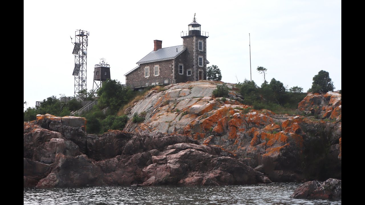
The Granite Island Lighthouse (#105 of 129) is located in Lake Superior off the shore of Michigan's Upper Peninsula.
Location: Lake Superior
Coordinates: 46°43′15″N 87°24′43″W
Structure: Stone and Brick
Year First Lit: 1869
Focal Height: 93 feet (28 m)
Lens: 4th Order Fresnel
Fun Fact: This lighthouse sits upon a 2.49 acre island and is completely energy independent through the use of solar panels, wind generators, storage batteries, and a backup generator.
Privately owned, thank you to Scott Holman for the tour.
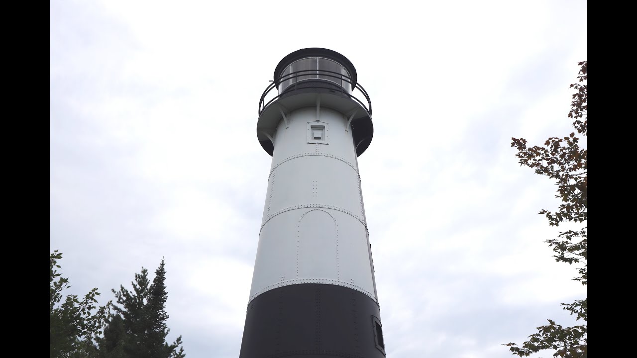
The Grand Island Harbor Rear Range Lighthouse (#102 of 129) is located just east of Christmas in Michigan's Upper Peninsula on the shores of Lake Superior
Location: Lake Superior
Coordinates: 46°26′12″N 86°41′28″W
Structure: Riveted Steel Plate
Year First Lit: 1868
Focal Height: 70 feet (21 m)
Lens: 6th Order Fresnel
Fun Fact; The original wooden Front and Rear Ranges were demolished in 1914. The Front Range was replaced by an iron mast, and again in 1968 with a D9 style steel cylinder. The new Rear Range is a riveted steel plate conical design that is one of the tallest, if not the tallest, lighthouses of this type on the Great Lakes.
Currently managed by Hiawatha National Forest
The Shoal Shoppe is home to a wide variety of fantastic lighthouse products, merch, and more! Check out our full collection and see what makes the beacons of Michigan so special.